Saturday 26.10.2024

Summary:

 Trekking MBC – Lower Sinuwa
 Start: 7:45, 3700m
 Finish: 15:00, 2200m
 Weather: Sunny, cool morning with leggings and thin gloves in addition to a long-sleeved shirt and shorts
 Drink: 2,3 L
 Expenses: 300 (Red Bull en route), 140 (coconut biscuits en route), 490 (Coke and water en route), 770 (Coke and Pringles at the lodge)

The goal had been reached yesterday, so now it was time to head out. Today was quite a descent into Lower Sinuwa, where we had stayed a few days ago. From MBC, Lower Sinuwa is the sixth village along the valley trail. The first three sections are basically all downhill. There is some up and down between Dovan and Bamboo, although this section is also mostly downhill. The section between Bamboo and Upper Sinuwa was the most difficult, with long uphills and ending higher than the starting point. The section from Upper Sinuwa to Lower Sinuwa was again pretty much all downhill.

Today’s sections:
 07:45 – 09:00 MBC (3700m) – Deurali (3200m)
 09:15 – 10:05 Deurali (3200m) – Himalaya (2900m)
 10:10 – 11:10 Himalaya (2900m) – Dovan (2505m)
 11:25 – 12:10 Dovan (2505m) – Bamboo (2190m)
 Lunch
 13:05 – 14:20 Bamboo (2190m) – Upper Sinuwa (2340m)
 14:30 – 15:00 Upper Sinuwa (2340m) – Lower Sinuwa (2200m)

It is surprisingly strenuous and slow to descend along rocky trails or steep stairs, but of course it is a lot easier than going up. Leg muscles do get a beating, but otherwise it feels more relaxed. We had climbed almost the same route two days earlier. It had taken us seven hours from Lower Sinuwa to Deurali, including lunch. Today we started one village further up, but based on the section times we left Deurali at 09:15 and arrived in Lower Sinuwa at 15:00, five hours and 45 minutes later, including lunch. It’s amazing how small the time difference was when you consider that Bamboo and Deurali have an altitude difference of pretty much exactly 1000 meters.

We stayed in the same guesthouse as previously and in fact even in the same room. A lukewarm shower did the trick, as did a plate full of chicken momos.

Sunrise as seen from MBC
Departing MBC
Descending along the valley
Proper highway
There were several improvised bridges along the route
After one hour of descending
Break in Dovan
Lunch break at Bamboo. This was the last place the ponies were allowed to go. From here upwards, everything is carried by porters.
Heikki took a quick nap after lunch
On the ABC trek, people were on the move with a really wide variety of equipment. Parasols, crocs, flip-flops...
Pasang carrying tourists' stuff
Local porter and gas delivery
Gas gas gas...
Local trekkers were so impressed by Heikki's age that they wanted a group photo.
Horseback in Lower Sinuwa

I drank a lot every day because of sweating and to ensure that my acclimatisation was working. Trail runners use backpacks with pouches for water bottles on the shoulder straps.  However, these backpacks are usually quite small, as are the bottles for them, so none of us used those. A hydration pouch is convenient in the sense that it is easy to get a drink at any time without having to stop and dig a bottle out of the backpack. Often the pouch is placed inside the backpack, but I didn’t want to do that because I had a laptop and other electronics in the backpack. My own backpack has an external gear flap, under which the hydration pouch could be secured with an extra strap.

In addition to the hydration pouches, we had a couple of Nalgene bottles to fill up in the evenings. Drinking water was either freshly boiled or filtered, whatever that meant in practice. At least I used to drop a water purification tablet into the bottles after I had filled them. Boiled or filtered water was not free, but it was included in our package with the food. Apparently it cost between 150 and 200 rupees per litre, which was pretty much the same price as bottled water. The price of bottled water, at least at higher elevations on the northern side of Annapurna, was surprisingly low considering how much it weighed and how far it had to be hauled by mule or porter. On the southern side of Annapurna on the route to the base camp, plastic bottles were banned. But glass soda bottles were allowed and abundant. It’s not like they would be exactly lightweight or biodegradable!

A hydration routine was quickly established. In the evening, I filled the Nalgene bottles with filtered water and added a purification tablet to each bottle. Pude mostly took boiled and hot water, but that’s a bit of a hassle when brushing teeth or having a sip in the evening. In the morning I mixed some sports drink powder in one of the bottles. It is definitely worth taking at least a half kilo bag of sports drink powder with you. Amrit claimed that the powder would be readily available, but that may only be true for Kathmandu, as I didn’t see it available in kiosks or shops in the smaller villages. A half kilo bag is meant for about 25 bottles, which was a suitable amount even for our two hike combo. I used the sports drink and about half a bottle of water to fill the hydration pouch. I packed the empty Nalgene bottle in the gear bag and the half full water bottle in the daypack. The water acted as a convenient reserve in case the pouch ran empty, which wasn’t easy to notice unless you check the pouch separately during the breaks. After brushing your teeth and possibly a few sips, the Nalgene bottles yield a total of about 1.8 litres in the morning. During lunch, a hot drink like tea or cocoa was always served, which added a couple of deciliters more. During the day, during lunch or a break, we virtually always had a Coke or some other soda, which was normally half a liter or, as we approached Annapurna Base Camp, a slightly smaller glass bottle. These totalled about 2.5 litres, which was sufficient for the hike unless the day was particularly hot or long. It was hot especially at lower altitudes, which meant that even more liquid was consumed. In such cases, bottled water had to be bought at lunch or the Nalgene bottles needed to be filled with filtered water.

The hydration pouch attached to the backpack
1.5L of drinks conveniently available (except at Thorong La Pass)

Sunday 27.10.2024

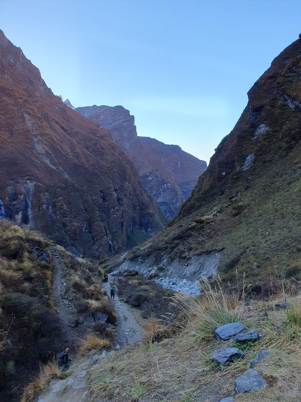
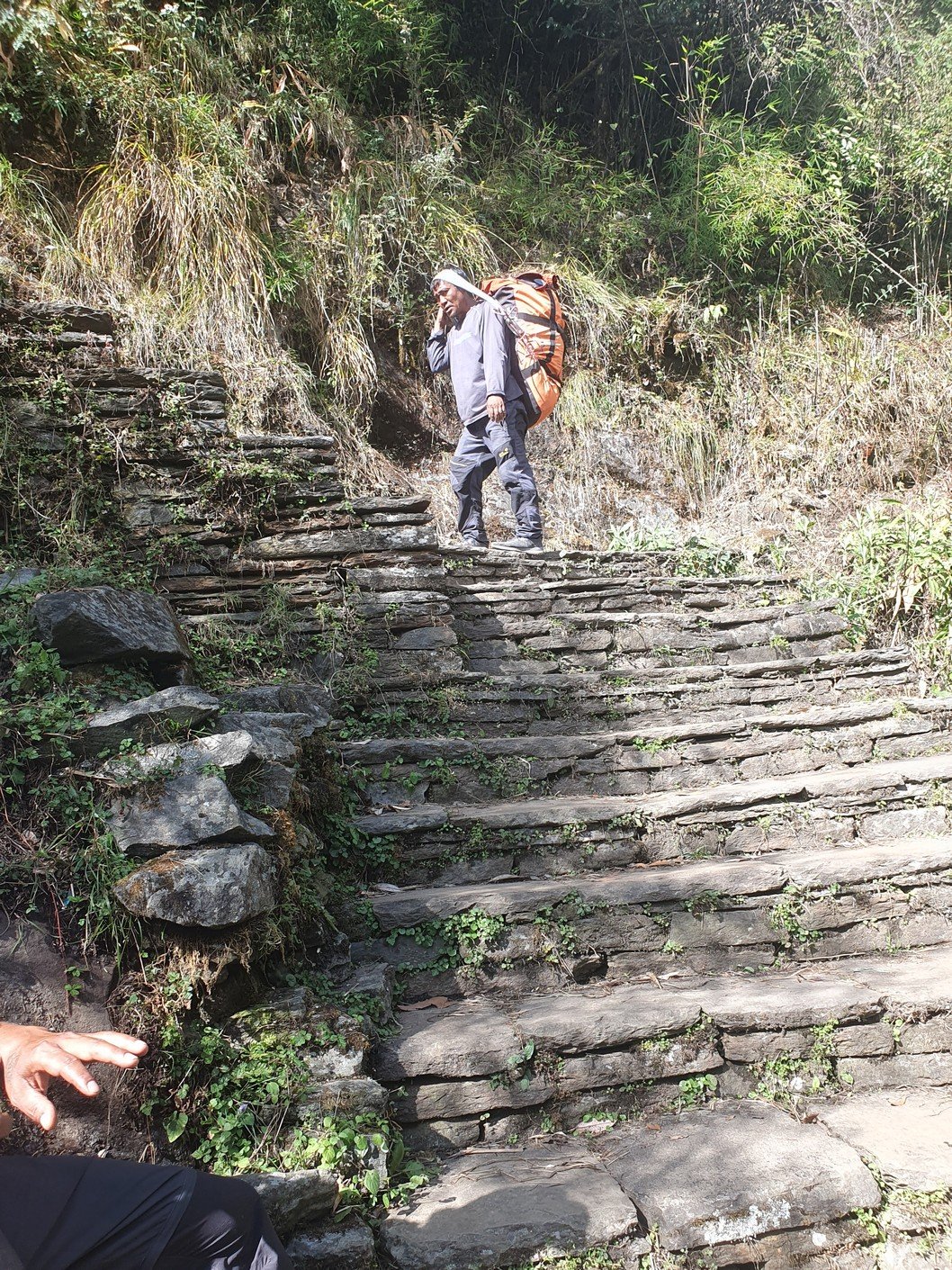
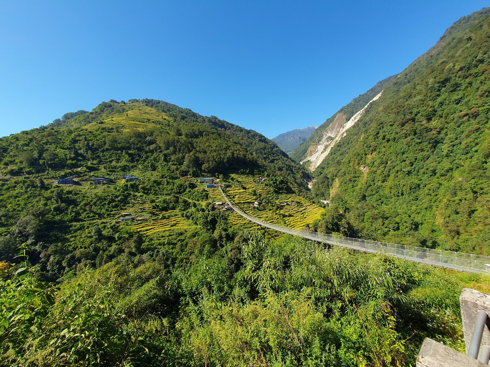
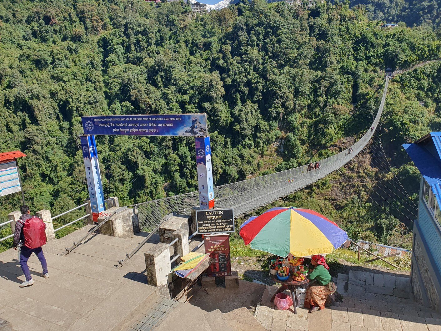
Today was the time for the last push. The end of the road and the ‘jeep station’ could be seen as far as Lower Sinuwa, but there was an unfortunately large gap between the line of sight and the actual trail. First, we had to descend for half an hour to a suspension bridge over the river flowing at the bottom of the valley. Then it was 1797 stairs up to Chomrong, where we had left our extra gear. From there we had to continue up 402 steps almost to the top of the hill, followed of course by an infernal descent to a suspension bridge. The bridge was by far the largest we had ever seen, and it also served as the starting point of the ABC trek. To be precise, it serves as the starting point only for those who just do the ABC trek and come to the end of the road with a jeep. We didn’t do this, as we spent several days trekking up and down the mountains from Tatopani via Ghorepani and Chuile to Chomrong.

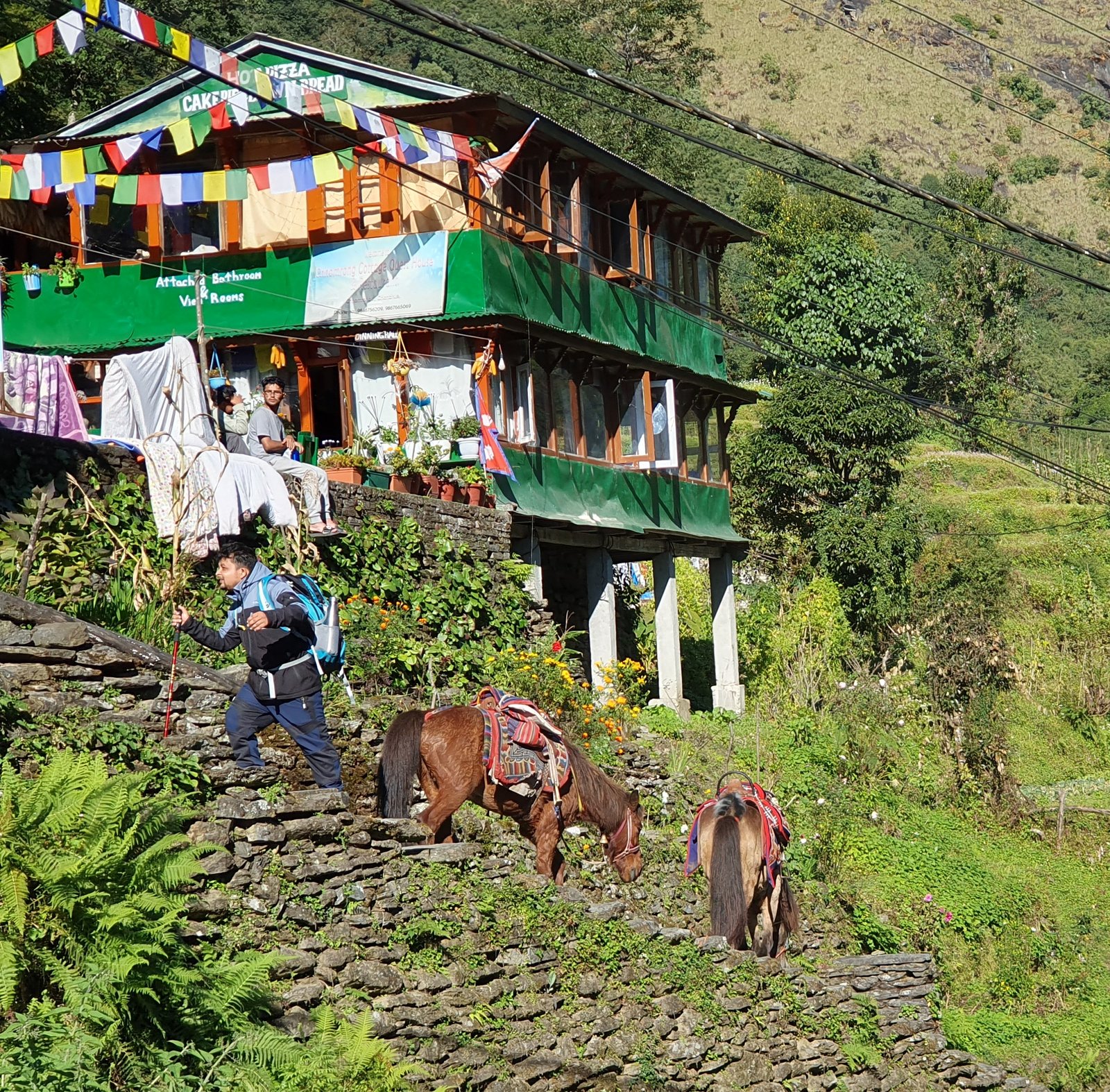
Pani means water in Nepali. Tatopani means hot water, which of course referred to the hot springs of Tatopani. Ghorepani meant ‘horse water’. According to Amrit, Ghorepani was still largely uninhabited until about fifty years ago. There were only shepherds herding their animals, and all the water had to be brought in from somewhere lower down. Presumably this was done with the help of mules, hence the name Ghorepani. Tarapani was even further away than Ghorepani, and the meaning of the name was ‘water that is far away’.

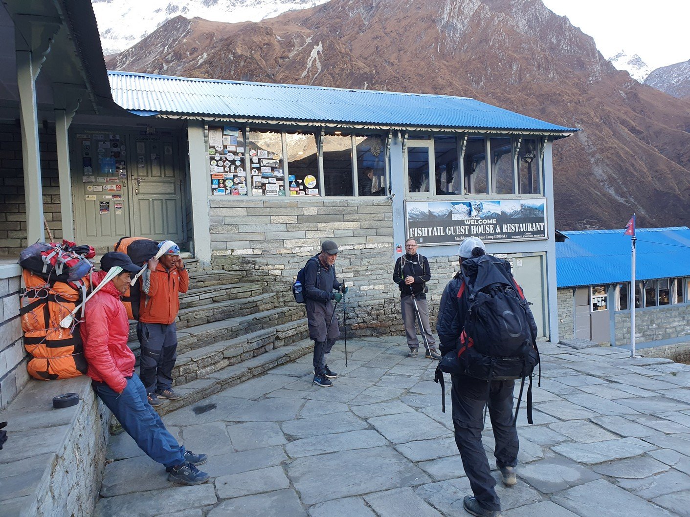
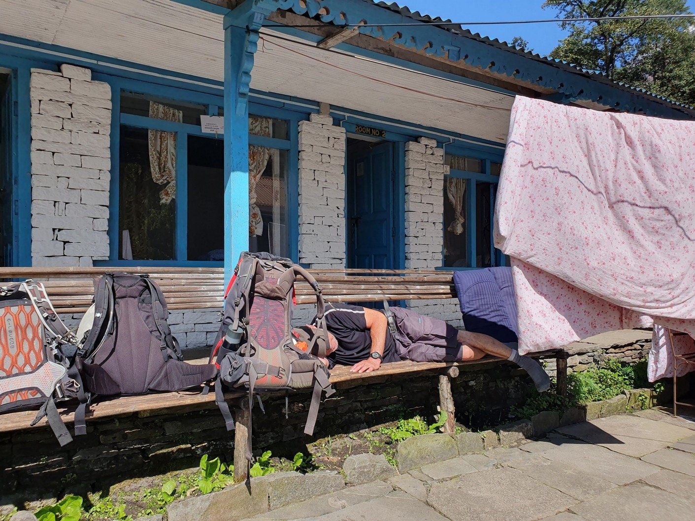
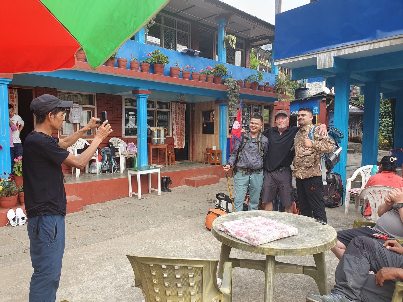
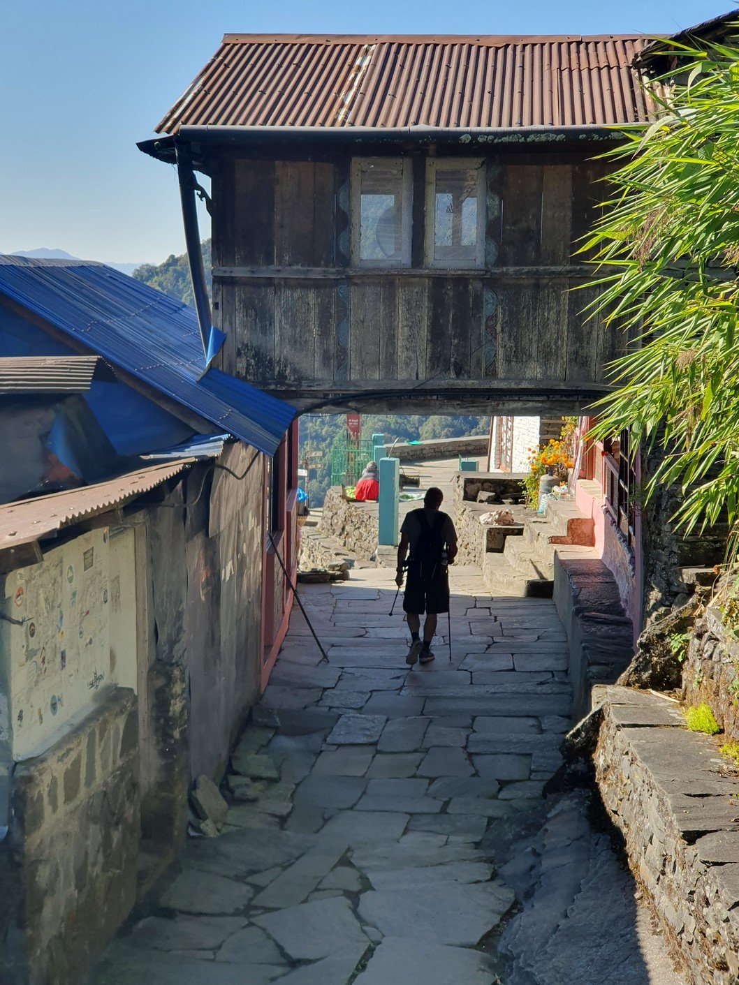
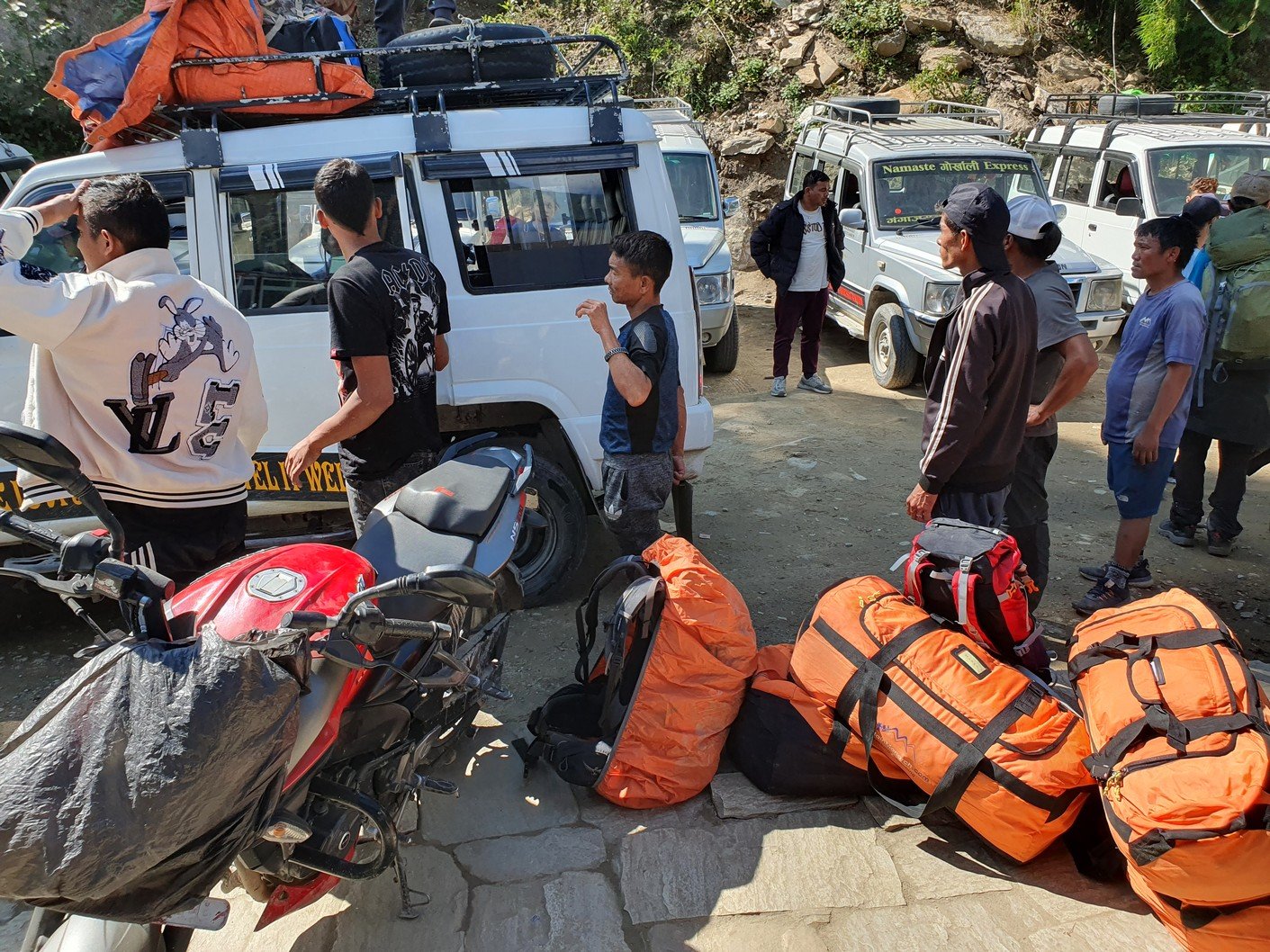
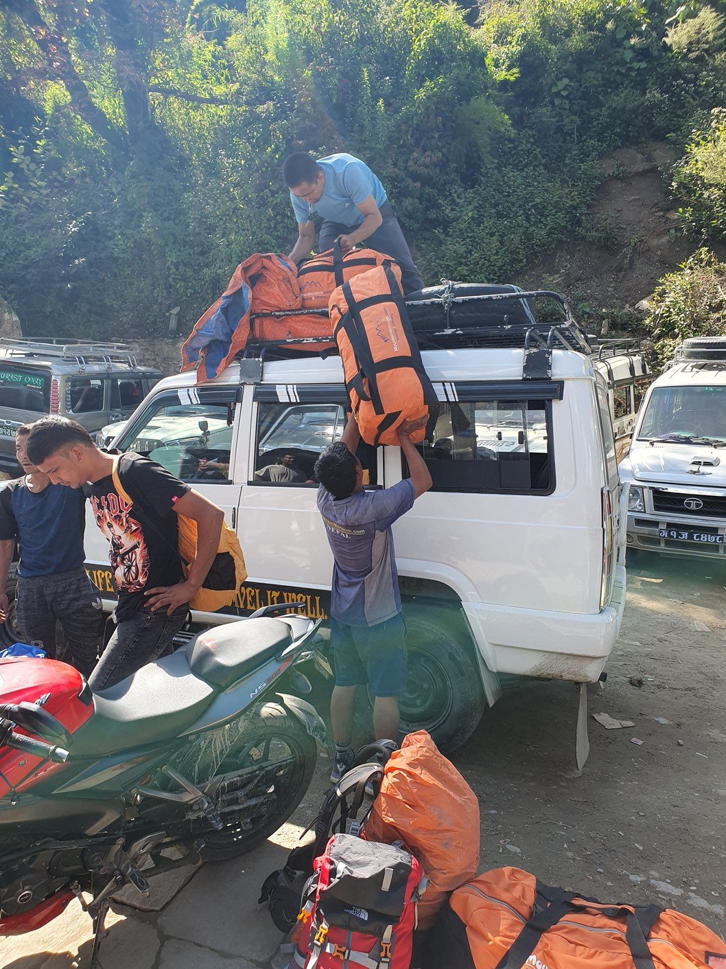
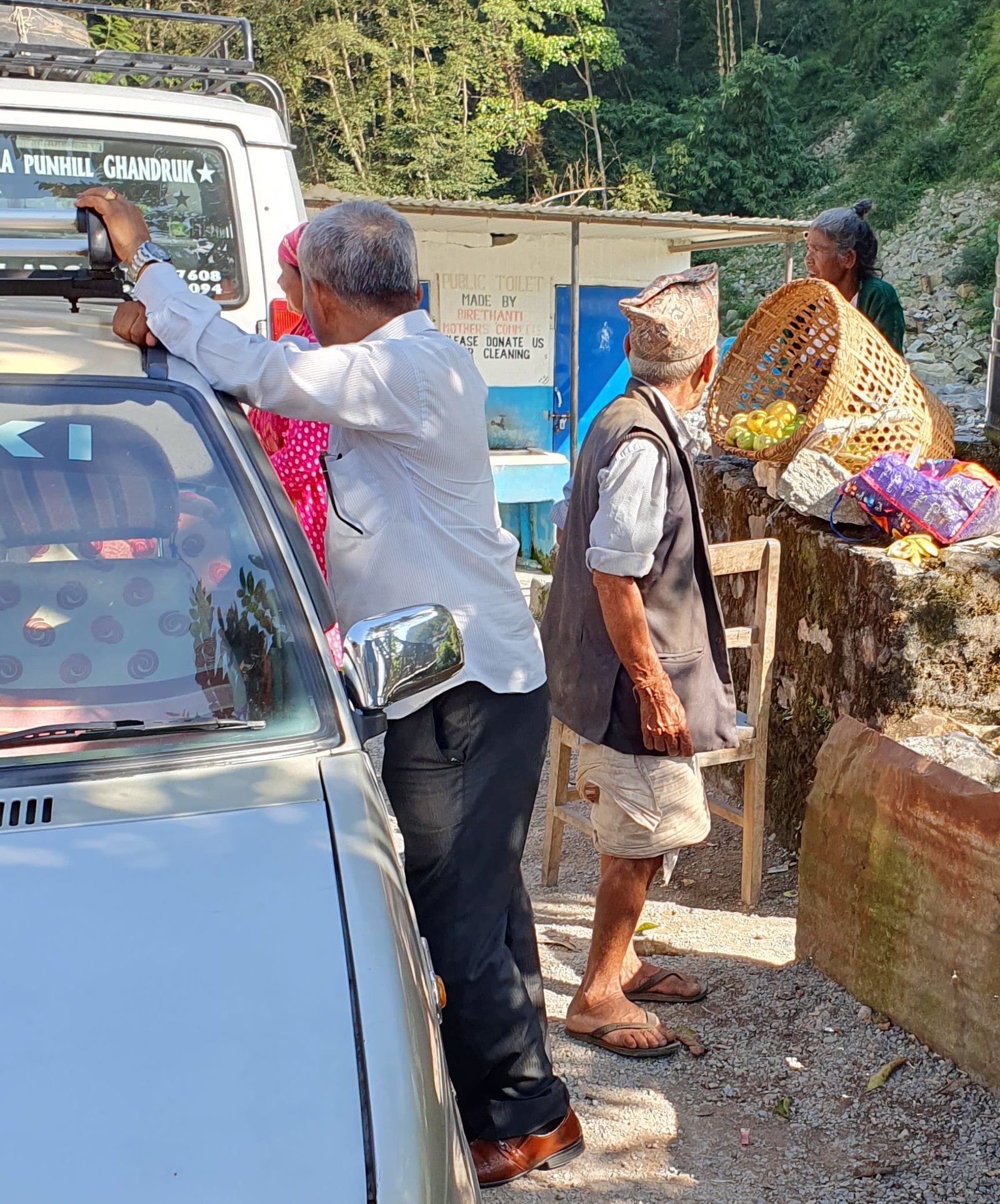
We set off at what had become the normal time at quarter to eight. We reached Chomrong surprisingly quickly by 9 o’clock. We packed the stuff we had left in storage back into the gear bags and Pasang and Sanjay tied the heavy bags together to be carried for the last time. After some drinks and photos, we were ready to move on towards the jeep station. Of course, the route to the start of the road cannot start directly from Chomrong, but first you have to continue up the steps to the top of the hill to start the descent.

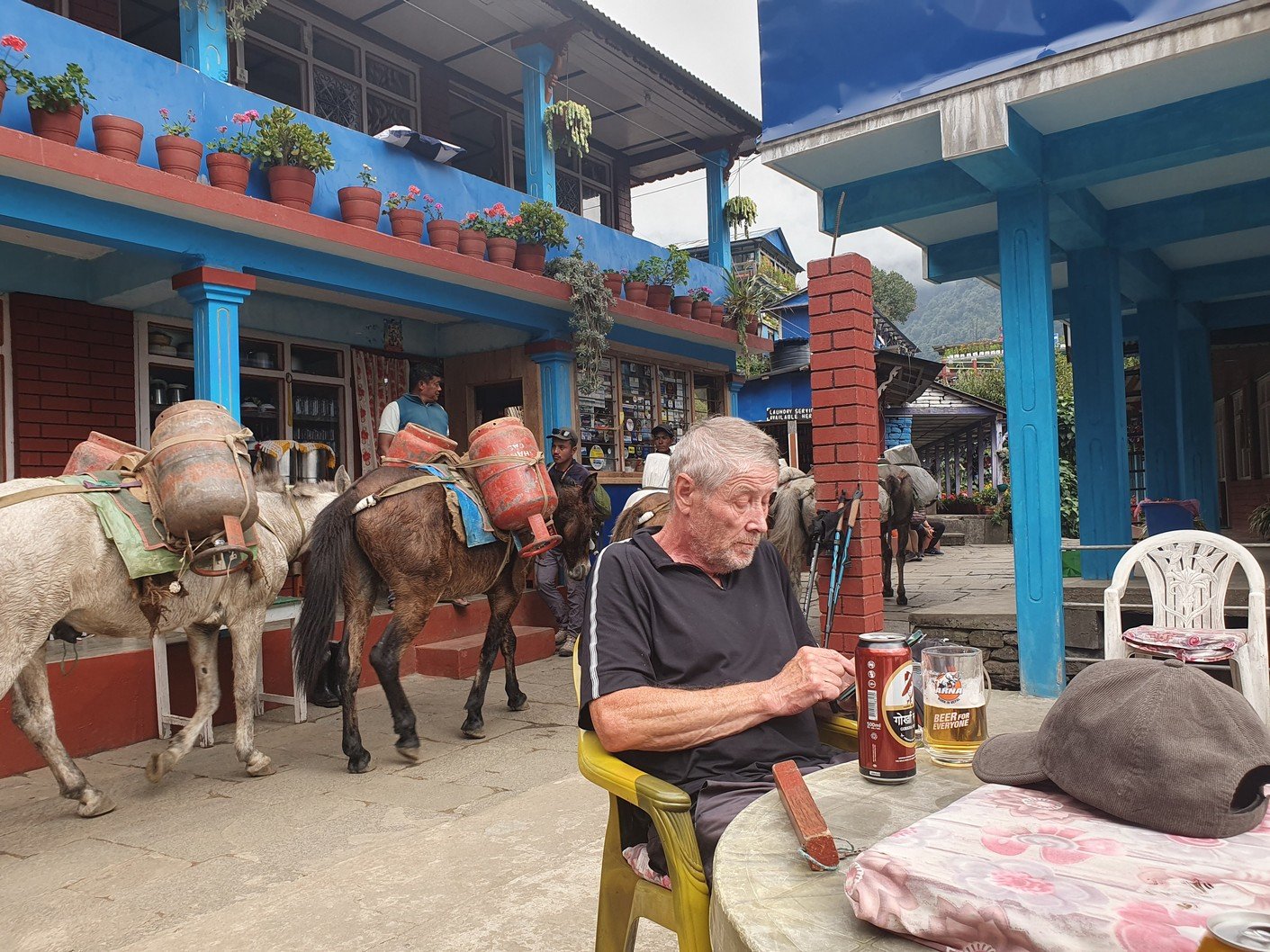
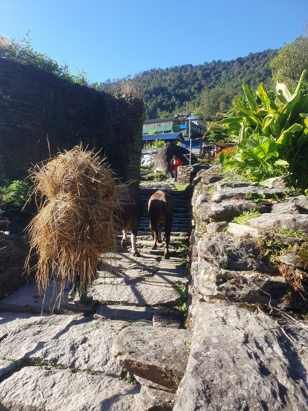
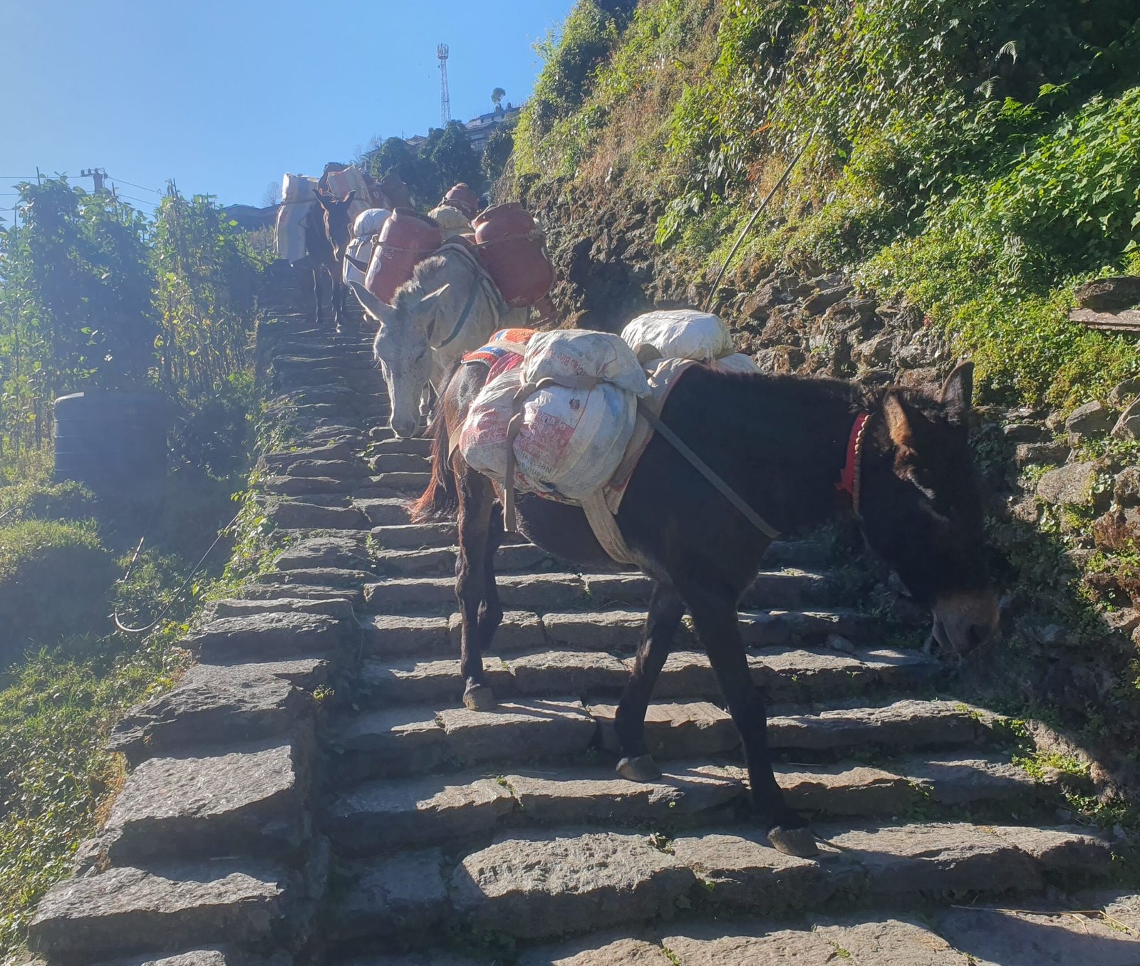
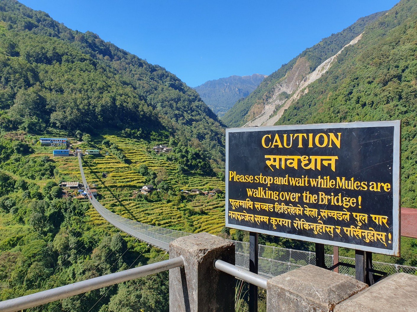
The Jhinu Danda suspension bridge over the river flowing at the bottom of the valley is quite an impressive structure. It is 287 metres long and has a maximum height of 135 metres, offering spectacular views. There is a warning sign at each end of the bridge prohibiting access if a mule caravan is already on it. As goods from the ABC area are brought by car to the end of the road and from there on mules or on the backs of porters, the animals are frequently on the move. We too had to wait because a convoy of half a dozen mules had just left the other side.

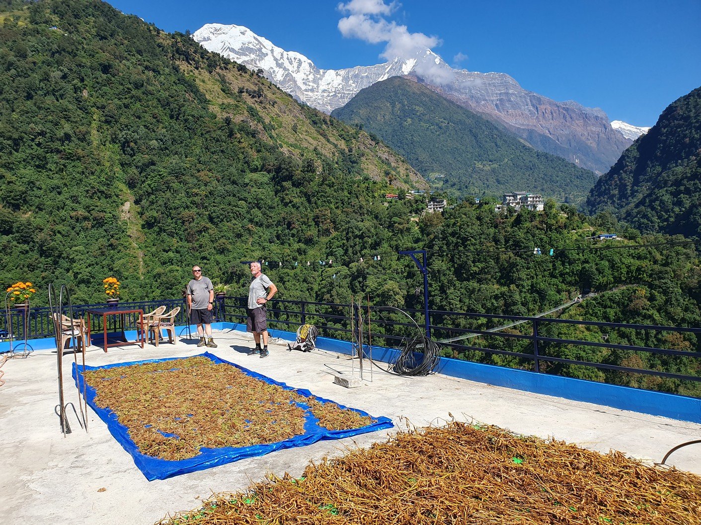
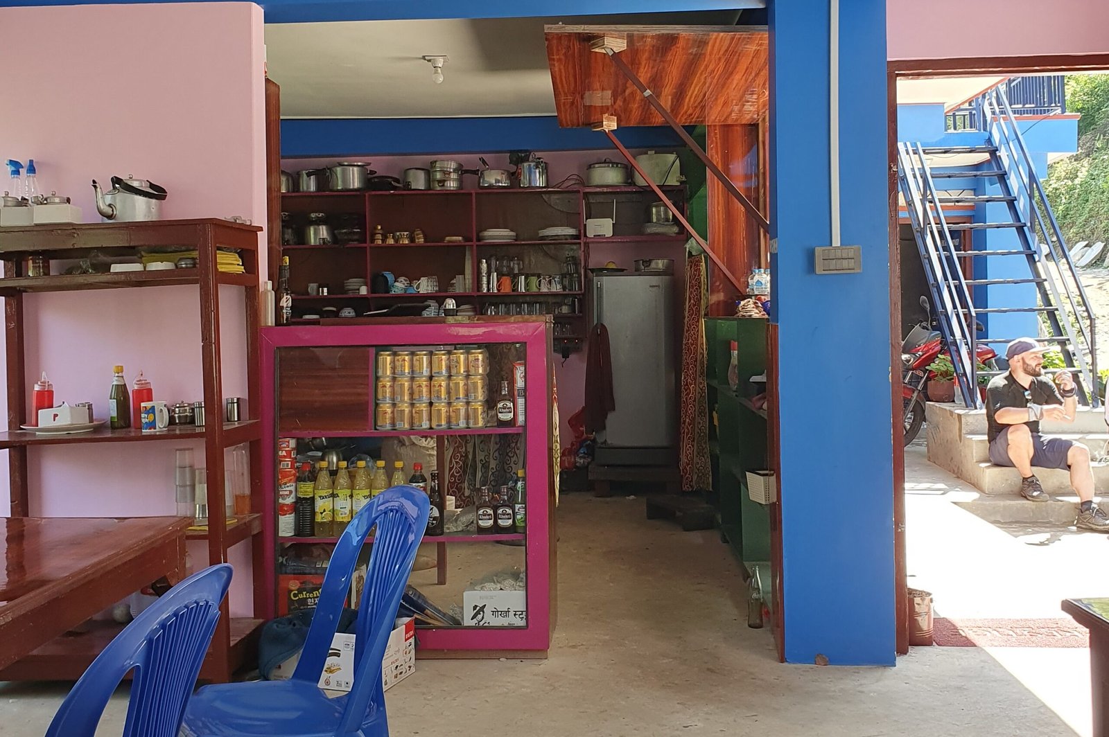
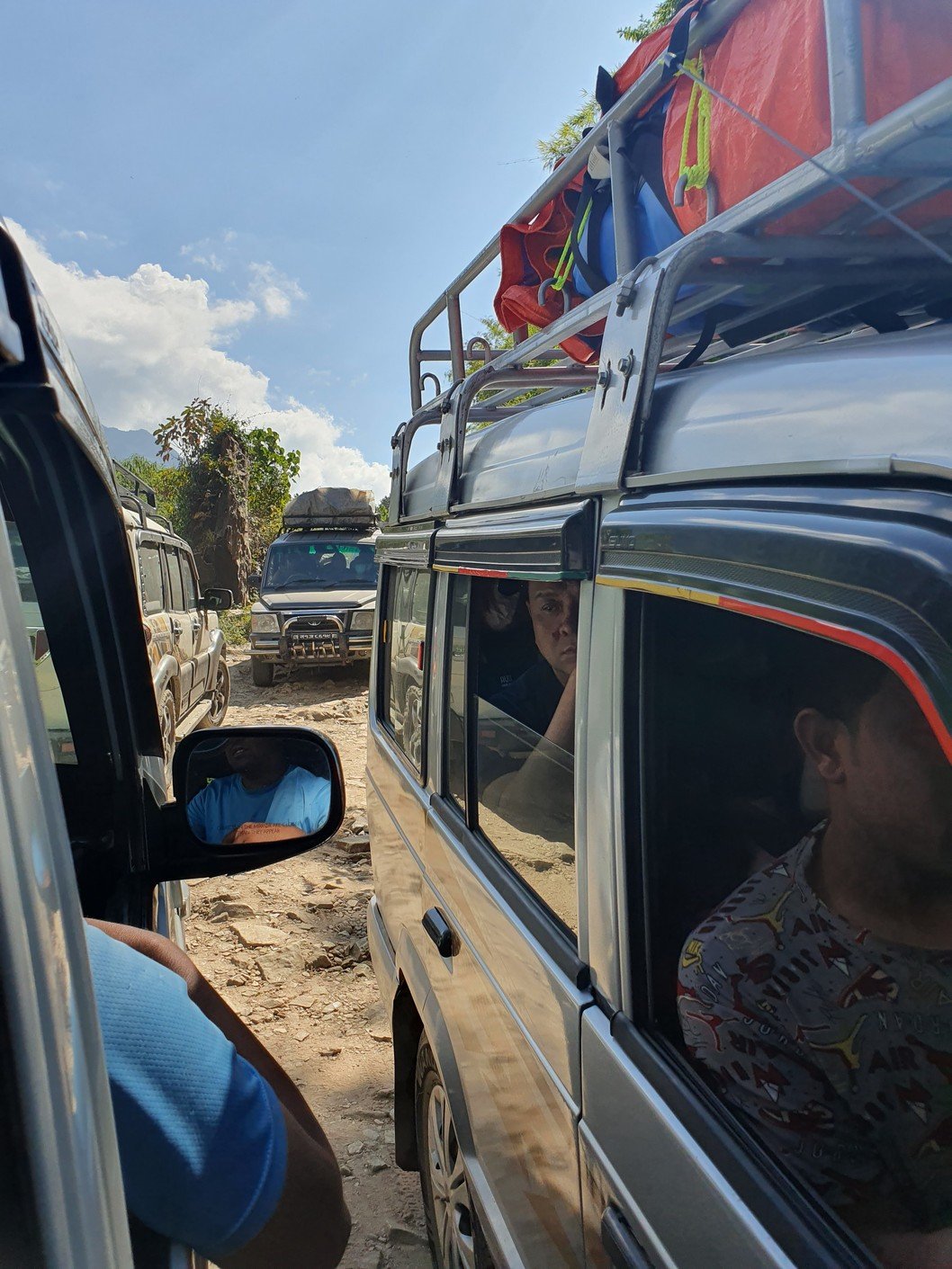
We arrived at the jeep station at quarter to eleven. We had time for a light lunch on a rooftop terrace before our ride was ready to go. The rooftop terrace was rustic to say the least, but the views were extraordinary. As the hike trip was now finished, we naturally had to celebrate it with a small bottle of Khukri rum. It was nice to sit on the roof terrace and sip Khukri cocoa. Since the little bottle was quickly finished off, we had to buy another one for the jeep ride.

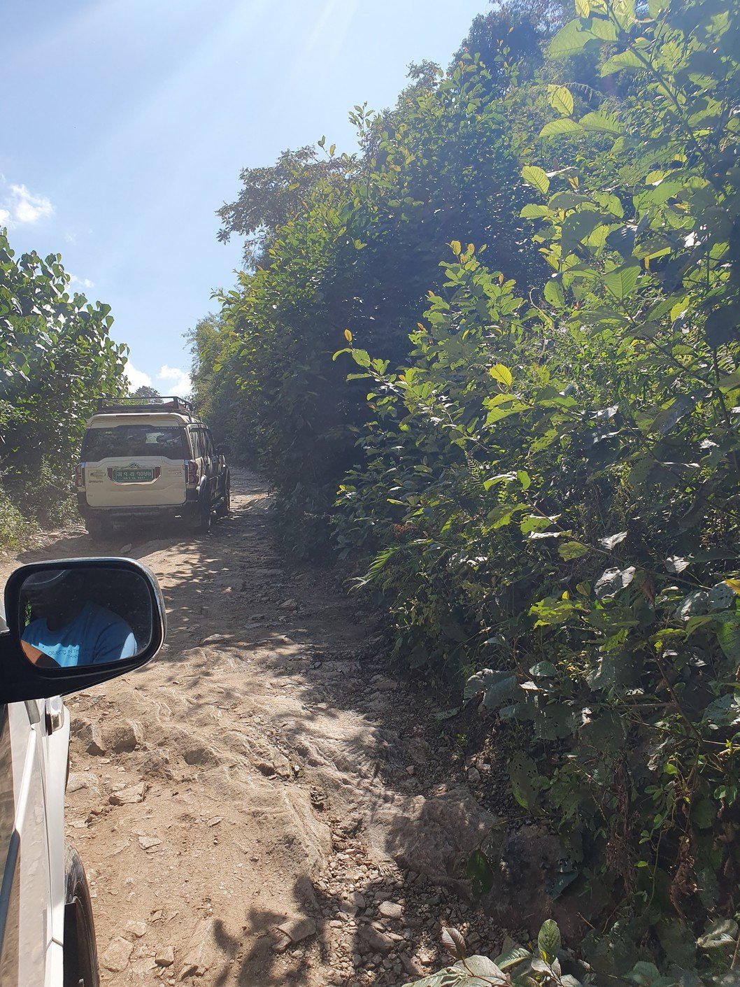
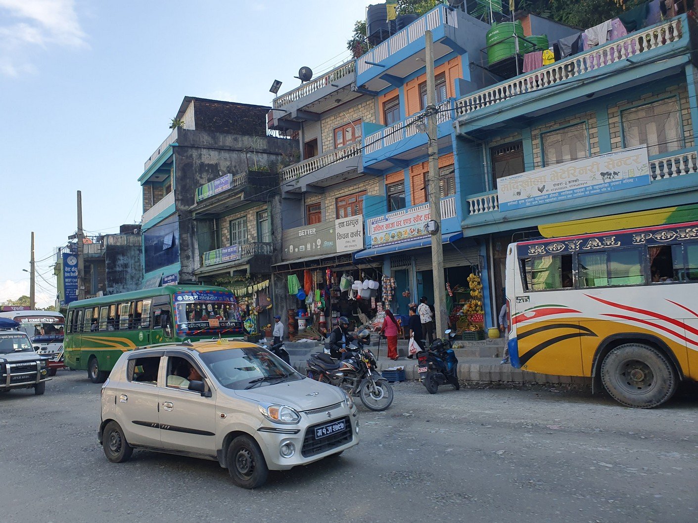
We knew that the road would start as an unpaved gravel track, but at some point it would turn into a ‘highway’ level main road. In politically correct terms, the change was subtle, but after two and a half hours we arrived in Pokhara, Nepal’s second largest city. Let the baccanals begin!

Last departure!
The holy cows should give way, the load of hay might be for them
Lower Sinuwa, where we started
Repacking the gear left in Chomrong
The road in sight!
Not the goalpost quite yet
A busy break place
Jhinu Danda Suspension Bridge. 287 metres long with a maximum height of 135 metres.
The sign was not in vain, a caravan was already on its way
We're done! The sign says 'Entry point of Annapurna Base Camp Trek'.
Our private roof terrace
Note the hole in the row of Khukri bottles on the bottom shelf
Jeep station
Stuff on the roof. Business as usual.
On a mule or on the back of a porter? Fifty-sixty...
If you walked, you'd be there already
So many people came out of the car to push it that we didn't need to join in to help
The road width didn't really match the traffic density
Public transport works, of course

Leave a Reply

Your email address will not be published. Required fields are marked *